When buying a home or land, understanding your property’s boundaries is essential. Whether you’re planning a fence, garden expansion, or just want clarity, knowing how to find your property lines can prevent neighbor disputes and costly mistakes. One key marker to identify? Iron stakes—often overlooked but critical for accuracy. Here’s a clear, practical guide to simplify the process.
Why Property Lines Matter
Before diving into the steps, let’s review why defining your boundaries is non-negotiable:
- Home Projects: Building a shed, fence, or driveway requires precise boundary knowledge to avoid overstepping.
- Legal Protection: Clear boundaries resolve disputes over land use, trees, or garden placement.
- Zoning Compliance: Local laws about construction setbacks rely on understanding your property limits.
- Smooth Sales: Defined boundaries streamline the selling process and avoid legal tangles.
Step 1: Review Your Property Deed
Your deed is the first stop for boundary details. It includes:
- Legal descriptions (e.g., measurements in feet and reference points).
- Terms like:
- Metes and bounds: Specific directions/distances outlining boundaries.
- Lot and block: Identifies your lot number in subdivisions.
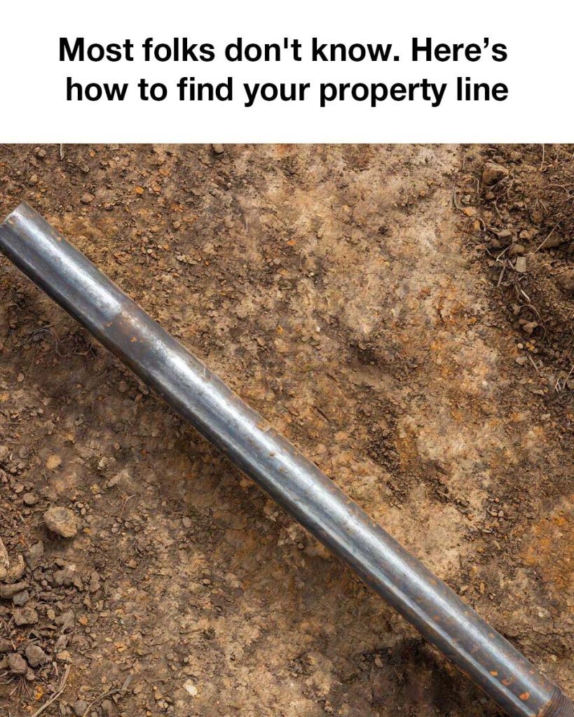
- Mentions of iron stakes/pins (corner markers from the original survey).
While deeds can be complex, they provide a baseline for your lot’s size and layout.
Step 2: Obtain an Official Property Survey
A licensed surveyor’s map is your blueprint for precision. It shows:
- Exact property lines, building placements, driveways, and iron stakes (a.k.a. “corner monuments” or “property markers”).
If you don’t have a copy, request one from your local records office or county clerk. This document is crucial for guiding your search for stakes.
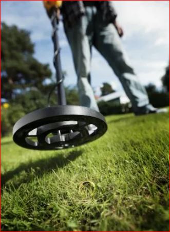
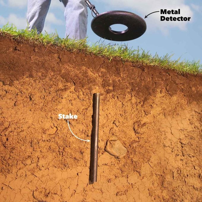
Step 3: Use a Metal Detector to Find Iron Stakes
Surveyors install iron stakes at property corners during initial land division. Over time, they may hide under dirt, grass, or landscaping. Here’s how to locate them:
Tools You’ll Need:
- Rent/borrow a metal detector (available at hardware stores or rental centers).
Steps:
- Use the survey as a map: Note distances between corners to narrow down stake locations.
- Sweep systematically: Move the detector slowly over the ground near suspected areas—listen for beeps/buzzes indicating metal.
- Dig carefully: If you get a signal, gently shovel the area. Stakes are usually just below the surface (a few inches deep at most).
What If Stakes Are Missing?
- Corrosion or old properties may mean stakes are gone. Hire a licensed surveyor to replace them or conduct a new survey.
Step 4: Leverage GPS Apps & Online Tools (for Guidance)
While iron stakes are most accurate, modern tech can help:
- GIS mapping systems (publicly available in most counties/cities) offer rough boundary estimates.
- Popular apps:
- LandGlide
- OnX Hunt
- Regrid
GPS isn’t inch-perfect, but it gives a starting point before using a metal detector for precision.
Step 5: Mark Your Boundaries
Once stakes are found, make lines visible with:
- Colored flags
- Temporary stakes
- Light fencing
This helps with planning projects or legal documentation.
Step 6: Hire a Professional Surveyor (When in Doubt)
If stakes elude you or boundaries remain unclear, a surveyor is worth the investment. They’ll:
- Conduct a thorough assessment
- Replace/mark corner markers
- Provide an official, legal survey
While there’s a cost, this ensures accuracy and avoids future headaches.
Final Tips for Success
- Start with paperwork: Deed + survey = foundational info.
- Patience pays off: Take time to sweep areas with the metal detector—rushing leads to missed stakes.
- Document everything: Photos of found stakes and marked boundaries create a record for future use.
Knowing your property lines brings peace of mind, protects your investments, and ensures you stay within your legal rights. With the right tools and steps, you can confidently define your space—or call in the pros when needed.